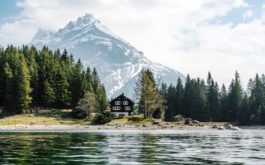
Minnesota offers more than 1,000 miles of trail that cater to all-terrain vehicles, off-highway motorcycles and off-road vehicles. Riders visiting the state can access trail guides which detail dozens of trails including maps covering the entire state.
Northwest and northeast Minnesota offer a particularly good range of areas and trails to explore. The trails vary in terrain, scenic sights, and amenities. There are trails to match every skill level, from flat and open trails that cater to beginners, to narrow, winding trails that will challenge even the most experienced riders.
The trails are largely the product of 20-plus years of work. Over time those who manage local, county and state lands have worked with ATV clubs to create an extensive network of trails through state forests, state wildlife management areas and other public lands and roadways.
Nearly 270,000 ATVs are registered with the Minnesota Department of Natural Resources. That number is similar to the number of licensed small game hunters in Minnesota and three times the number of waterfowl hunters.
Here are some of the state’s most notable spots to ride ATVs.
IRON RANGE OFF-HIGHWAY VEHICLE STATE RECREATION AREA
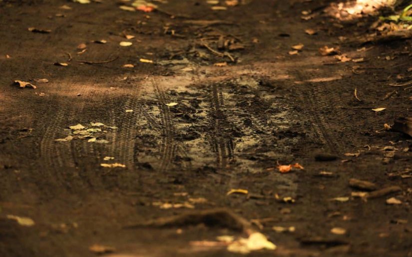
Located in Gilbert, Minnesota’s premier ATV park features 36 miles of trails for riders of every skill level. Explore 1,200 acres of former mine lands with rugged hills, muddy basins and regrown forested trails. Climb, ride, get muddy or tear it up: It’s your choice on these well-marked trails offering a wide variety of experiences for all levels of rider. Popular trails include Big Aspen (21-mile closed system), Alborn-Pengilly Trail (39 miles) and Chisholm ATV Trail (11 miles).
NEMADJI STATE FOREST TRAILS
These trails near Moose Lake wind through the state forest. There are connections to the Matthew Lourey State Trail and the Gandy Dancer Trail, affording riders more than 100 miles of trail-riding options.
SOO LINE NORTH TRAIL
The 52-mile trail, much of which is in the scenic Bowstring State Forest, begins in Remer and ends near Cass Lake. It’s common for riders on this trail to see a variety of forest wildlife species.
SPIDER LAKE TRAILS
Located near Pine River, the 29-mile trail is in the Foot Hills State Forest and includes a variety of terrain.
TROUT VALLEY TRAILS
Situated in the Richard J. Dorer Memorial Hardwood State Forest near Winona, this 9-mile trail culminates with stunning views of the Mississippi River, and Trout and Whitewater valleys.
APPLETON AREA RECREATIONAL PARK
This park near Appleton features 20 miles of trails that cater to riders of all skill levels.
FOREST RIDERS TRAIL
This 100-mile trail begins near Park Rapids and takes riders through several state forests. Some parts of the trail are level, while others are hilly and more challenging.
FOURTOWN-GRYGLA TRAIL
Riders can access this trail in a variety of locations, including at Grygla. At 170 miles, it’s among the state’s longest and offers generally flat and easy riding.
ITASCA TRAILS
In Itasca County, thousands of acres of land are open to off-highway riders. With loads of lakes, the Chippewa National Forest, and George Washington State Forest, there are a plethora of trails including 18-mile Little Moose Trail and Thistledew a 25-mile closed loop system offering varied terrain, scenery and riding challenges. There is also the 21-mile UPM Blandin Trail. Itasca County offers over 200 miles of ATV trails many of the roads in the county are open to ATV travel.
BAUDETTE/WARROAD AREA
The Warroad/Roseau trail system and the Bemis Hill trail system includes nearly 200 miles of trail and is located in the northeast corner of the 700,000 acre Beltrami State Forest. Trails in the Beltrami State Forest mostly travel along pine covered ridges, large flatlands and look out over peat bogs. Carp’s Pit Recreation Area is a popular picnic and resting area for Warroad/Roseau trail riders. A picnic area exists for Bemis Hill riders, too.
GRYGLA AREA
This area features the Fourtown-Grygla and Con-Con trails, located immediately south of the Warroad/Roseau and Bemis Hill trails. The Fourtown-Grygla trail system covers 170 miles. Much of the trail follows county roads, township roads, ditch banks and existing trails. Riders in this area may see the occassional moose as well as black bear, sandhill cranes and many different waterfowl species.